Drone Survey and Mapping
Completing a mapping mission or building a digital twin is about much more than flying the drone.
What are the benefits of drone based surveys?
Reduce field time and survey costs: Capturing topographic data or a digital twin with a drone is up to many times faster than land-based methods and requires less resources.
Provide accurate and extensive data: The use of drones equipped with survey grade GPS (RTK/PPK) and appropriate ground control delivers accurate and repeatable results.
Map otherwise inaccessible areas: An aerial mapping drone can take off and fly almost anywhere. You are no longer limited by unreachable areas, unsafe steep slopes or harsh terrain unsuitable for traditional measuring tools.

Mission Planning
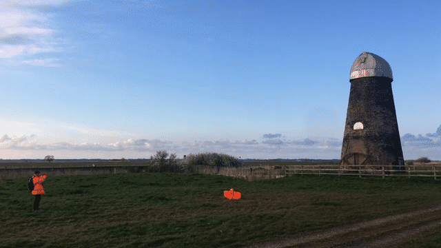
Good planning and preparation is key to the safe acquisition of high quality high accuracy drone mapping and modelling data.
From the legal aspects of flying a drone, to ground control to the data capture strategy we plan each aspect to ensure you get the drone data you need. We have extensive experience of working in congested areas, sites of special scientific interest (SSSIs) and complex industrial sites - including top tier COMAH sites.
We execute surveys regularly that are over 800 HA, these missions involve many flights, onsite logistical support (power, welfare etc) and can produce terabytes of source data.
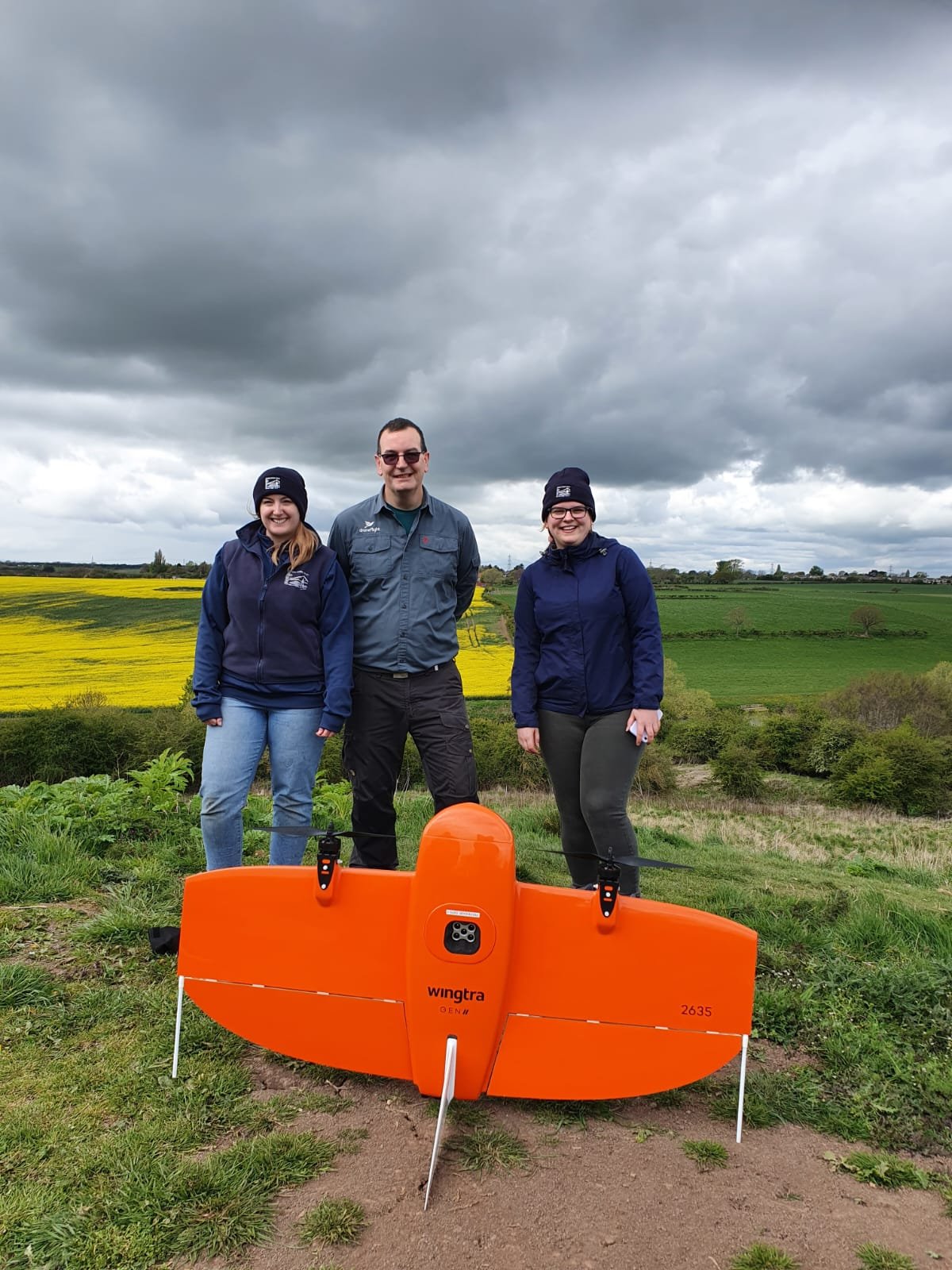
WingtraOne GEN II
WingtraOne GEN II has a unique set of features that make it an ideal platform for surveying and mapping. It is a vertical take off and landing drone, this means it can operate in more confined areas than a traditional fixed wing drone. With a cruise speed of 36mph and high resolution cameras, on site data capture is very efficient - able to capture up to 100Ha in a single flight in about an hour. Equipped with a survey grade GPS it delivers highly accurate models without excessive ground control points.
The ground breaking oblique payload enables the production of high quality digital twins that can be captured very efficiently. For more information click here.
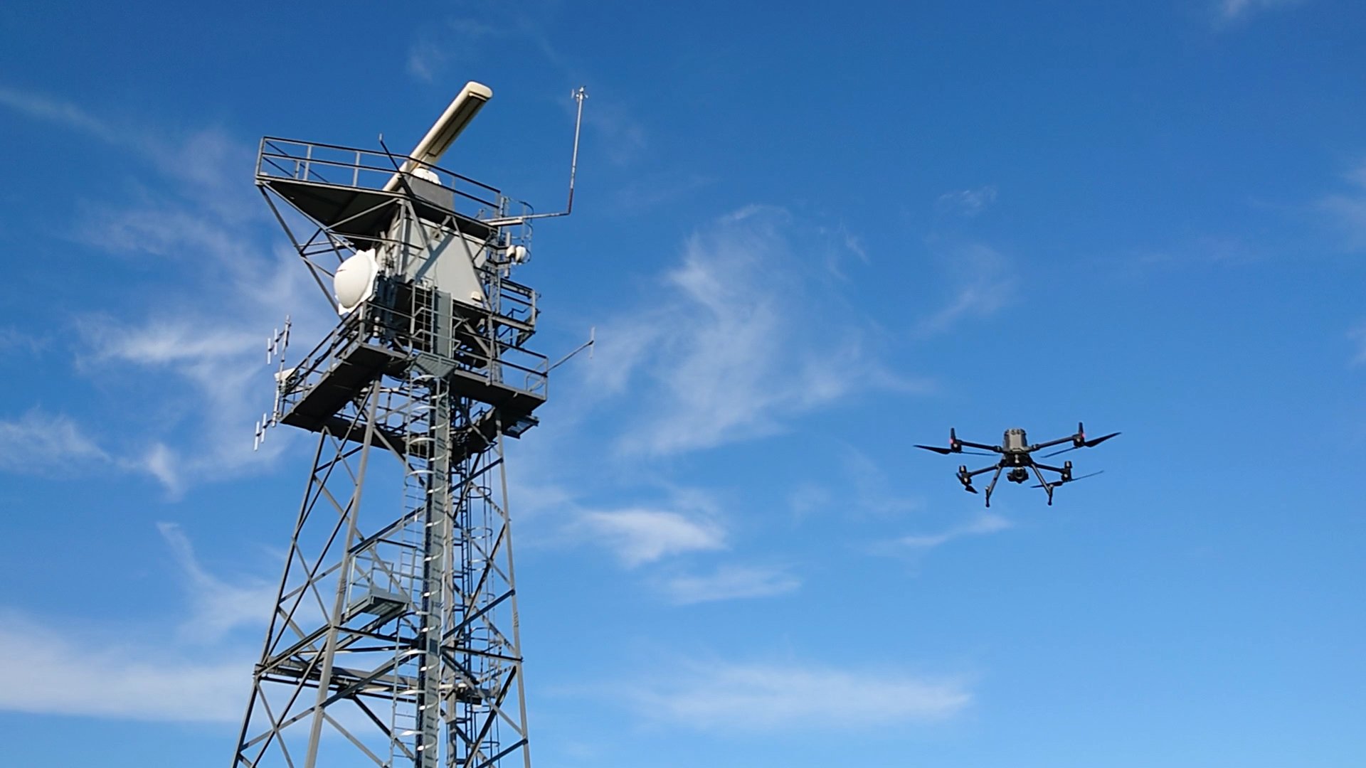
DJI M300 and P1
The DJI M300 is paired with the 45MP DJI P1 camera to provide a great multirotor based platform for photogrammetry data capture. The flexibility of a multirotor drone enables vertical scanning of objects and very close photography to create mm levels of detail in models (usually for heritage buildings).
The M300 is equipped survey grade RTK GPS that can deliver highly accurate photogrammetry surveys to our customers.

Establishing quality
A drone survey needs to be accurate and you also need to be able to verify this. To meet these needs we use drones with survey grade GNSS equipment on board and we establish ground control using survey grade GNSS systems. The quality of the equipment and how we use it enables us to produce high accuracy surveys every time.

Processing the data
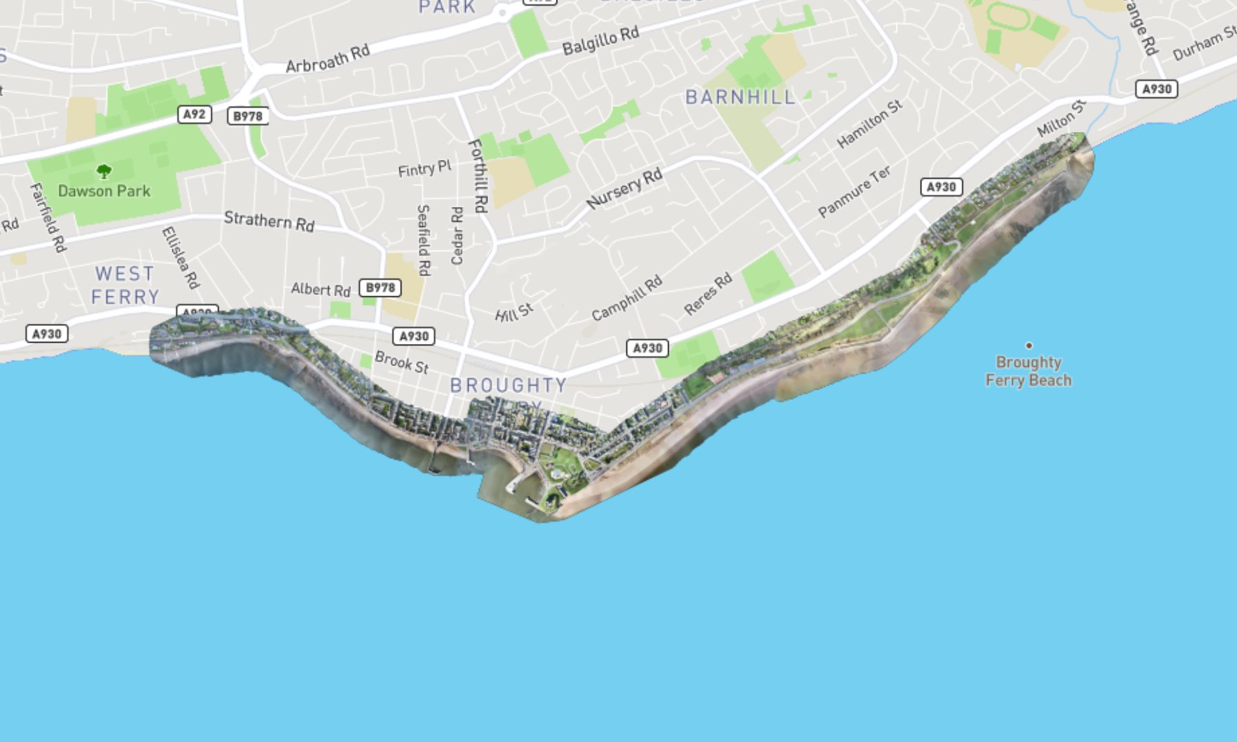
We process our data using industry leading tools including PIX4D Matic and Bentley Context Capture for photogrammetry. When we go beyond the models and process the data into charts we use a range of tools dependant on the client requirements and we work with partners who specialise in different types of data. If you need simple charts or complex drawings of every elevation we can help.
Case Studies
Mapping Jetties
We were commissioned by our client to undertake the mapping and production of CAD drawings of an area containing 3 industrial jetties on Teesside.


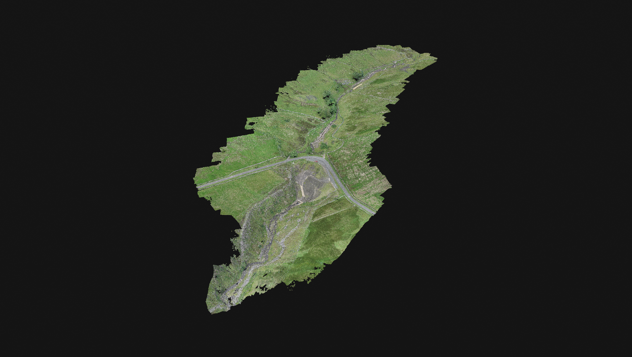
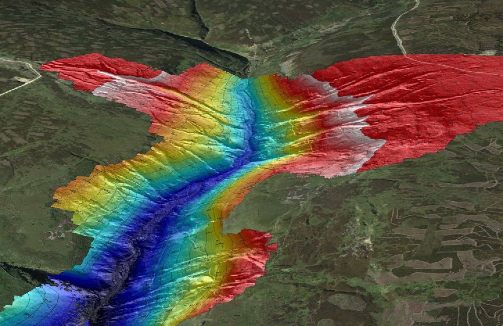
Programme of Large Topographical Surveys
We were commissioned to complete topographical surveys of a number of former metal mines in the Yorkshire and Durham Dales.